See also
+ The Sky for February 2013
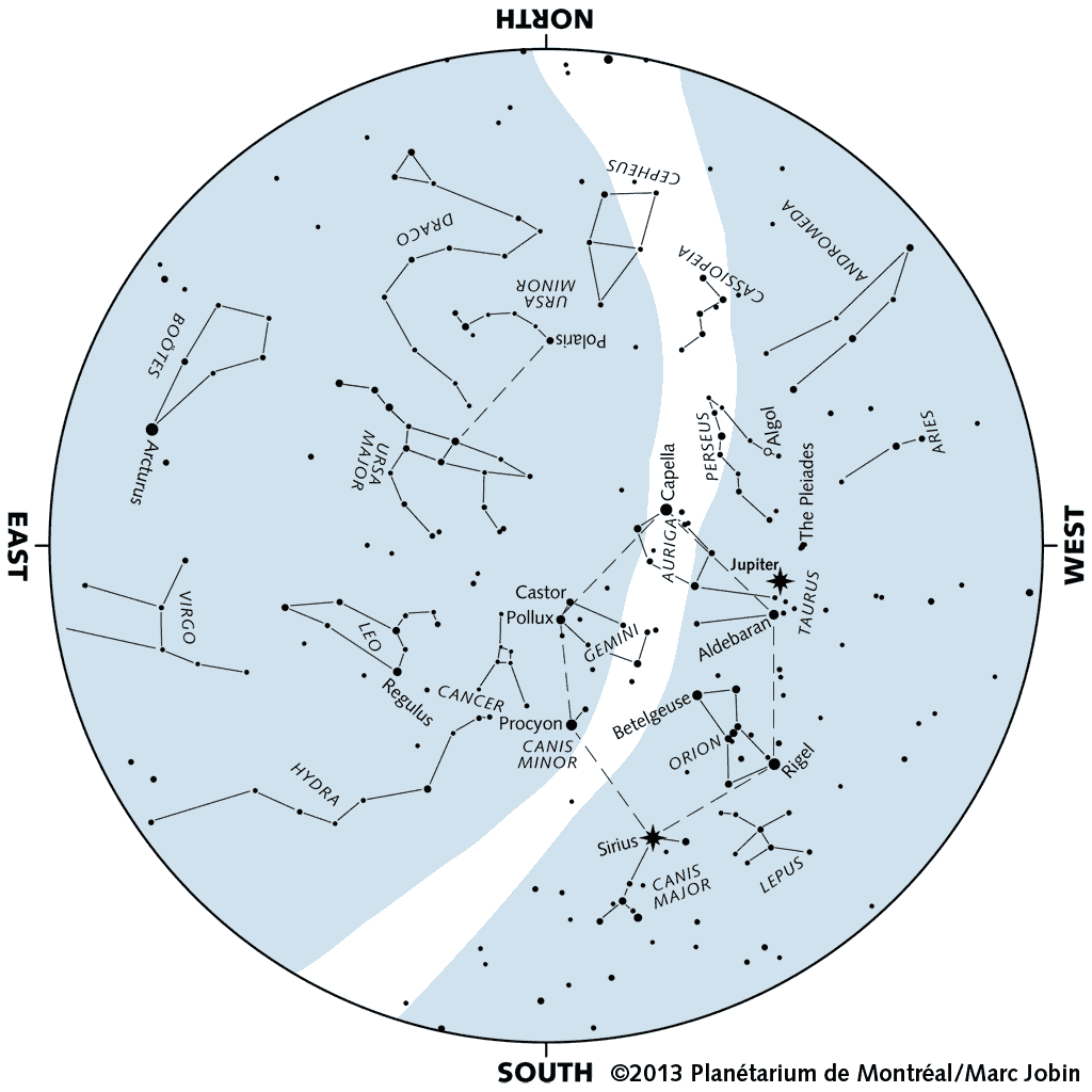
About the map
The star map at right represents the evening sky as it can be seen in February, 2013.
This map is valid at
- 22:30 on February 1st (EST)
- 20:30 on February 15 (EST)
- 19:30 on February 28 (EST)
It remains perfectly usable for a few hours before and after the times indicated above. The position of planets is indicated for February 15, 2013.
Lines joining stars represent the major constellations. The light-colored area shows the approximate contours of the Milky Way.
To use the map, hold it in front of you and turn it until the direction you're facing appears at the bottom. You'll then be able to match the map with the actual sky, and become acquainted with the great figures of ancient mythology.
|
|
|
To print this map
Click on the map to download the high resolution version, that you can then print in "full page" mode.
Windows: open the image with Preview and follow the instruction to print it at the maximum size allowed on your current paper size..
Mac OS X: using the Preview utility, make sure that the "Shrink large images to fit printed page" option is selected, and print normally.
|
|