| At the time of its incorporation, Ville Saint-Laurent only covered a small territory. Its first mayor was Édouard Gohier; and it was also represented by a few city councillors. There were 225 homes in its territory, most of which were built from wood, as well as several companies and four hotels. Little by little, the city annexated parish land until it surrounded it completely in 1954. Here are the dates of the most significant annexations. |
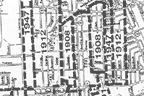
Map of annexions
|
|
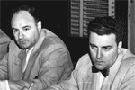
Municipal Council
|
1901 A section of land is added to extend the city to the southwest to Cardinal Street.
1908 A strip is added to include Décarie boulevard to the west and Dutrisac street to the east.
1912 The city expands from east to west. |
| 1949 Land is added to the east up to the Laurentides Autoroute and at the west of Laurentien boulevard (today Marcel-Laurin boulevard) to Bertrand street.
1953 Annexation of territory to the north of du Ruisseau boulevard to the Canadian National railway tracks.
1954 Annexation of the remainder of the Saint-Laurent Parish. |
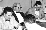
Municipal Council
|
1964 Incorporation of the Notre-Dame de Liesse municipality owned by the Grey Nuns.
Today, Saint-Laurent covers two thirds of the territory of the former parish, since the other third was divided between the former municipalities of Montréal, Dorval and Mont-Royal. The existing territory covers 43 square kilometres.