|
|
|
 |
|
 |
MapIndexProfileSearchFrançais |
 |
|
|
|
|
|
|
|
|
|
|
|
|
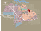
Norvick
In 1942, the construction of 248 single-family homes began in Saint-Laurent. These homes formed the small working-class district known as Norvick.
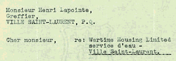
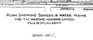
Construction began after the Canadian government created Wartime Housing Limited, a company mandated to build homes across Canada in response to the needs of the thousands of workers participating in the war effort.
Considered the first city suburb, Norvick is located near the Noorduyn Aviation Ltd and Vickers aerospace plants. The district was named after these two companies.
|
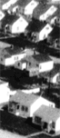
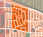
View of the neighbourhood
|
The homes erected by Wartime Housing were practically identical. They had neither foundations nor basements, and had very small yards. Although they were smaller homes, their avant-garde characteristics often made them the envy of residents of other working-class neighbourhoods. The original plan was to demolish them after the war, although the government decided instead to sell them to the families who lived in them.
|
Although this small district that was somewhat removed from the rest of the city was eventually surrounded by new homes, it still stands out today from the rest of the municipality due to its circular shape.
|
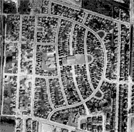
Aerial photo of Norvick neighbourhood
|
|
|
|
|
|
|
|
|
|
© 2001-2013 All rights reserved, Ville de Montréal
777 boulevard Marcel-Laurin, Saint-Laurent (Québec) H4M 2M7
Tel. : (514) 855-6000 Fax : (514) 855-5709
|
|
 |
|
 |
|
|
|